
Mount Everest. The World’s highest mountain, tallest peak. Also called Sagarmatha (Nepal, meaning “Head of the Sky”), Chomolungma (Tibet, meaning “Goddess Mother of the World”), Qomolangma (China), Zhumulangma (Pinyin) and originally named peak XV, peak 15 when it was discovered and classified. Mount Everest is a part of the Himalaya range in High Asia, located on the border between Sagarmatha zone of Nepal and Tibet.
The mountain was first observed and recorded from great distance as “peak b” in november 1847. In 1856, the Great Trigonometric Survey of India established, after several years of calculations, the first published height of Everest at 29002ft (8840m). The most current official height is 8848m (29029ft), first determined by an Indian survey in 1955, and subsequently reaffirmed by a 1975 Chinese measurement. Because of the still active geological forces Mount Everest rises by approx. 1 centimeter (0.4 Inch) per year, and move simultaneously towards the northeast at a speed of 6 centimeter (2.4 Inch) per year.
Asked “Why climb Mount Everest?” George Mallory is famously quoted as having replied “Because it’s there!”. During the British 1924 Mount Everest Expedition Mallory and his climbing partner Andrew Irvine both disappeared somewhere high on the North-East ridge during their climb.
The New Zealander Edmund Hillary, and the Nepalese Sherpa Tenzing Norgay, was the first to reach the summit of Mount Everest at 11:30 local time the 29th of may 1953 after a climb up the southern face.
The mountain, while not posing substantial technical climbing difficulty on the standard routes still has many inherent dangers such as altitude sickness, weather and wind. The highest mountain in the world attracts climbers of all levels. By the end of the 2007 climbing season, there had been 3679 ascents to the summit by 2436 individuals and Everest has claimed 210 lives. In average 2 to 4 fatal casualties every year since the start of the mountains exploration.
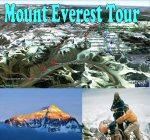
About the “Mount Everest tour”:
This is a series of placemarks and tracks that will give an impression of the climbing tour from basecamp(s) to the top of the world. The 2 major routes (out of at least 18 routes) are (roughly) shown in red (North Col, Northeast ridge) and blue (South Col, Southeast ridge). Camp positions are primary based on locations during the first ascents more than 50 years ago. Up till today both strength of climbers and climbing gear has developed so that a few camp locations may be obsolete at present time. Several places of mountain climbing interest along the two routes are also pinpointed. The tour is divided into 5 main folders; “The Summit (Around the Everest top)”, “Southern area including Southeast ridge (South Col) route”, “Northern area including Northeast ridge (North Col) route”, “Eastern area” and “Peak Pictures – Mount Everest”. Additional folders are “Map, Route, Zone Overlays”, “Geological Overlays”, “Track4Play”, “How to get to basecamps on Mount Everest…” and “Historic imagery links” gives various opportunities to explore the area around the highest mountain on earth supplied with on/off clickable grids, maps and images. The ‘Play tour’ option of GE will take you on a trip on first the south, then the north and then the east approach. Finally we take a flight around the summit. And end up in displaying a series of old and new pictures from around Mount Everest. Also available are 4 tracks, “track4play” each one designed to take you from the south, north, east or west areas, to or very near the top. Just ‘play the track’ and let GE do the climb! Consider using a viewing angle of 80 degrees or above. To ajust viewing angle, choose menu ‘Tools’, ‘Options’, Click the tab ‘Touring’ and change the ‘Camera Tilt Angle’ to 80 degrees. The default is 45-60 (below 80) degrees. Please note that all tracks are very much approximations of the plausible route and nothing near the exact climb. No one has been hurt during the use of this for climbing (mostly because no one hopefully has used them), but they will, if they do!!! The ‘South Col’ tour is considered the ‘easy’ trip, but I believe that people taking (the real) tour to the top of Everest are really tough people, no matter what route they take! Even from satellite pictures and Google Earth terrain feature you get a feeling (and I guess never near the real thing) of how really really big this mountain is! Tour creator: Tom Kjeldsen, created march 2008. Recommended to be viewed as a ‘Play tour’ in Google Earth with terrain feature enabled.
Mount Everest tour network links file: dooley.dk/Mount-Everest-tour-network-links.kmz
***** This file is available at ge.dooley.dk and also downloadable at GEC – Have a nice google earth tour… Let’s explore!