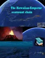
Google Earth Hacks | File Downloads | Categories | Most Popular | Newest | Top Rated | By State | By Country
Google Earth Hacks Login | Register    
Logging in will reduce the number of ads that you see    
 
(advanced search)

Subscribe in a reader Subscribe in a reader
Subscribe by e-mail Subscribe by e-mail
Follow on Twitter Get updates via Twitter
Follow on Twitter Follow me on Twitter
Connect on Facebook Connect on Facebook

Dig Deeper


Files Available For !The Ocean

Sort by date | Sort by name


Files in !The Ocean

RatingDate AddedDownloads 

Worlds largest cruise ship on the way to Fort Lauderdale, FL

Worlds largest cruise ship on the way to Fort Lauderdale, FL

At 0:18AM local time here in Denmark worlds largest cruise ship MS Oasis of the Seas passed the Great Belt Bridge in Denmark after it left STX Europe, Shipbuilding in Turku, Finland the day before ...
Rating of 5.0011/01/2009864Google Earth Logo
Google Maps Logo
Virtual Earth Logo
Yahoo Maps Logo
Google Earth Plug-in

Long Arrow Pointing To ?

Long Arrow Pointing To ?

Located a very visible long submerged arrow submerged underwater pointing to a specific location that looks like what was a rectangular structure. Is it a map artifact or is it a terrain shaped fea...
Rating of 5.0010/30/20091,433Google Earth Logo
Google Maps Logo
Virtual Earth Logo
Yahoo Maps Logo
Google Earth Plug-in

Date Line

Date Line

The International Date Line (IDL) is an imaginary line on the surface of the Earth opposite the Prime Meridian where the date changes as one travels east or west across it. Roughly along 180° longi...
Rating of 5.0009/30/2009381Google Earth Logo

The Golden Fleet

The Golden Fleet

This fleet of luxury yachts is owned by Khalid bin Sultan bin Abd al-Aziz, a Saudi with an interest in science, particularly in Oceanography. The fleet even includes a seaplane that 'docks' on one ...
No rating yet08/31/2009457Google Earth Logo
Google Maps Logo
Virtual Earth Logo
Yahoo Maps Logo
Google Earth Plug-in

Yemenia Flight 626 crash site

Yemenia Flight 626 crash site

Yemenia Flight 626 was a scheduled commercial flight operated by Yemenia en route from Sana'a, Yemen, to Moroni, Comoros that crashed on 30 June 2009 at around 1:50 a.m. local time (22:50 on 29 Jun...
No rating yet07/20/200956Google Earth Logo
Google Maps Logo
Virtual Earth Logo
Yahoo Maps Logo
Google Earth Plug-in

Air France Flight 447 crash site

Air France Flight 447 crash site

Air France Flight 447 was a scheduled commercial flight from Rio de Janeiro, Brazil, to Paris, that on 1 June 2009 crashed into the Atlantic Ocean, killing all 216 passengers and 12 crew members.
No rating yet07/20/200993Google Earth Logo
Google Maps Logo
Virtual Earth Logo
Yahoo Maps Logo
Google Earth Plug-in

Air India Flight 182 bomb explosion site

Air India Flight 182 bomb explosion site

Air India Flight 182 was an Air India flight operating on the Toronto-Montréal-London-Delhi-Bombay route. On 23 June 1985, the airplane operating on the route was blown up in midair by a bomb in Ir...
No rating yet07/20/200978Google Earth Logo
Google Maps Logo
Virtual Earth Logo
Yahoo Maps Logo
Google Earth Plug-in

sunk shores

sunk shores

GE got BIG errors!!
I found many shores even roads sunk into the seas in some districts due to the new GE version mapping errors. I don't think this is a forgiving mistake.
Rating of 4.0006/22/2009312Google Earth Logo
Google Maps Logo
Virtual Earth Logo
Yahoo Maps Logo
Google Earth Plug-in

Submarine clouds

Submarine clouds

Clouds underneath the ocean surface. This may be the reason for the sunny weather on the Pacific islands. ;-)
Rating of 4.6703/27/2009604Google Earth Logo
Google Maps Logo
Virtual Earth Logo
Yahoo Maps Logo
Google Earth Plug-in

Ocean Features - Underwater Ridge

Ocean Features - Underwater Ridge

A ridge, that is underwater.
No rating yet03/02/2009516Google Earth Logo
Google Maps Logo
Virtual Earth Logo
Yahoo Maps Logo
Google Earth Plug-in

Ocean Features - Seamount

Ocean Features - Seamount

Relatively common features in the ocean, here is a sample Seamount; an underwater mountain, ie. a mountain that is underwater and fails to reach the surface.
No rating yet03/02/2009331Google Earth Logo
Google Maps Logo
Virtual Earth Logo
Yahoo Maps Logo
Google Earth Plug-in

The Letter V

The Letter V

Made out of what look like lines from space in the ocean.
Rating of 4.0003/02/2009461Google Earth Logo
Google Maps Logo
Virtual Earth Logo
Yahoo Maps Logo
Google Earth Plug-in

Wreck of German Battleship Bismarck

Wreck of German Battleship Bismarck

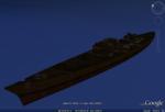
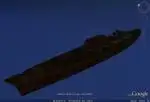
Note: Must have 3D buildings layer enabled to see this.
The German battleship Bismarck is one of the most famous warships of the Second World War. The lead ship of her class and named after...
Rating of 3.0002/24/20092,585Google Earth Logo
Google Earth Plug-in

Wreck of USS Oriskany - 3D Model

Wreck of USS Oriskany - 3D Model

Note: Make sure your 3D buildings layer is on or you won't see anything.
Ex-Oriskany was the first warship slated to become an artificial reef, under authority granted by the fiscal 2004 Nat...
Rating of 4.0002/24/2009965Google Earth Logo
Google Earth Plug-in

Bathyscaphe Trieste - 3D Model

Bathyscaphe Trieste - 3D Model

Make sure your 3D Buildings layer is activated, otherwise you won't see anything. Hard to navigate with a mouse. Hold alt for small movements, or use a 3D mouse.

If you want a hardc...
No rating yet02/24/2009699Google Earth Logo
Google Earth Plug-in

Proposed Site of Atlantis

Proposed Site of Atlantis

A rectangle filled with perpendicular criss-crossing lines on the ocean floor off the coast of Morocco. It has been proposed this is the site of Atlantis.

http://en.wikipedia.org/wik...
Rating of 2.5002/20/20092,989Google Earth Logo
Google Maps Logo
Virtual Earth Logo
Yahoo Maps Logo
Google Earth Plug-in

Giant Squid versus Sperm Whale - In 3D

Giant Squid versus Sperm Whale - In 3D

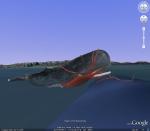
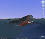
When you turn on your 3d buildings layer in Google Earth 5 and move to this placemark, you see a whale and a squid duking it out.
Rating of 3.2502/18/20098,242Google Earth Logo
Google Earth Plug-in

Mariana Trench Tour

Mariana Trench Tour

Deepest part and place of the world's oceans. Mariana Trench and Ridge, with ridge islands and Challenger Deep. The Challenger Deep is the deepest surveyed point in the oceans, with a depth of abou...
Rating of 3.7502/16/20091,882Google Earth Logo

Dredger at sea

Dredger at sea

Dredger at sea.
Rating of 4.5002/16/2009728Google Earth Logo
Google Maps Logo
Virtual Earth Logo
Yahoo Maps Logo
Google Earth Plug-in

Deepest Point (-35717 Feet) on Google Earth

Deepest Point (-35717 Feet) on Google Earth

The deepest points on Earth (Google Earth atleast), located at -35,717 feet (at the head of the pin). That's a little over 6.75 miles down! http://en.wikipedia.org/wiki/Challenger_Deep
No rating yet02/06/20092,746Google Earth Logo
Google Maps Logo
Virtual Earth Logo
Yahoo Maps Logo
Google Earth Plug-in

> > Next Page > >


Google Earth Hacks is not affiliated with Google in any way

"Google" and "Google Earth" are trademarks of Google Inc.

Google Earth Hacks © 2005 - 2009 MickMel, Inc - Privacy Statement

GEH in the News - GEH en Español - GEH auf Deutsch - GEH en Français